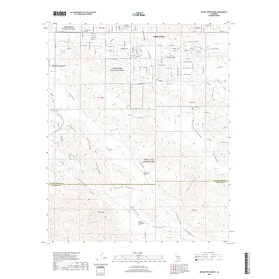
2018 Map of Joshua Tree South
USGS Topo · Published 2018About this map
Joshua Tree National Park dominates the southern half of this landscape, where the high desert terrain transitions into the Little San Bernardino Mountains. This modern survey illustrates the proximity between the desert communities of Yucca Valley and Joshua Tree and the vast federal lands of the Twentynine Palms Main Base. Hikers and geologists can trace the complex network of desert trails and washes, such as Quail Wash and the paths leading through Upper Covington Flat. The map highlights critical water sources in an arid environment, including Coyote Hole Spring, Covington Spring, and Quail Springs. Notable topographic landmarks like Eureka Peak and the unique formation of Cerro de la Silla provide essential orientation points for those navigating the rugged canyons and flats of the San Bernardino and Riverside County border.
Find a feature on this map
72 named features on this map. Tap any name to fly to it.
Don’t see what you’re looking for? This feature index may not catch every label — zoom into the map to look around manually.
Map Details
Editions of this 2018 Joshua Tree South Map
This is the sole edition of this map. No revisions or reprints were ever made.
Other maps of this area

1941 · Edom
USGS Topo · 1:62,500

1944 · Edom
USGS Topo · 1:62,500

1944 · Pinyon Well
USGS Topo · 1:62,500

1947 · Santa Ana
USGS Topo · 1:250,000

1949 · Santa Ana
USGS Topo · 1:250,000

1953 · San Bernardino
USGS Topo · 1:250,000

1955 · Twentynine Palms
USGS Topo · 1:62,500

1955 · Joshua Tree
USGS Topo · 1:62,500

1956 · San Bernardino
USGS Topo · 1:250,000

1956 · Santa Ana
USGS Topo · 1:250,000