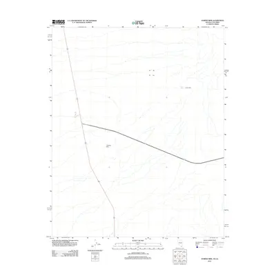
2012 Map of Juniper Mine
USGS Topo · Published 2012About this map
Juniper Mine sits tucked into the arid expanse of Clark County at the start of the 21st century, marking a landscape defined by desert industry and high-desert terrain. This survey illustrates the isolation of the Chiquita Hills, where the land is scored by intermittent drainages and natural features like Juniper Spring. The infrastructure here is sparse, characterized primarily by the junction and pathways of state highways 95 and 163, which provide the only major conduits through this region of southern Nevada. The map captures the quiet intersection of mining history and modern transportation corridors, offering a clear view of the topographical relief and water sources that dictated where human activity took root in this challenging environment.
Find a feature on this map
5 named features on this map. Tap any name to fly to it.
Don’t see what you’re looking for? This feature index may not catch every label — zoom into the map to look around manually.
Map Details
Editions of this 2012 Juniper Mine Map
This is the sole edition of this map. No revisions or reprints were ever made.
Other maps of this area

1886 · Camp Mohave
USGS Topo · 1:250,000

1892 · Camp Mohave
USGS Topo · 1:250,000

1926 · Mohave City
USGS Topo · 1:96,000

1942 · Camp Mohave
USGS Topo · 1:250,000

1947 · Kingman
USGS Topo · 1:250,000

1948 · Kingman
USGS Topo · 1:250,000

1950 · Davis Dam
USGS Topo · 1:62,500

1952 · Davis Dam
USGS Topo · 1:62,500

1954 · Kingman
USGS Topo · 1:250,000

1955 · Kingman
USGS Topo · 1:250,000