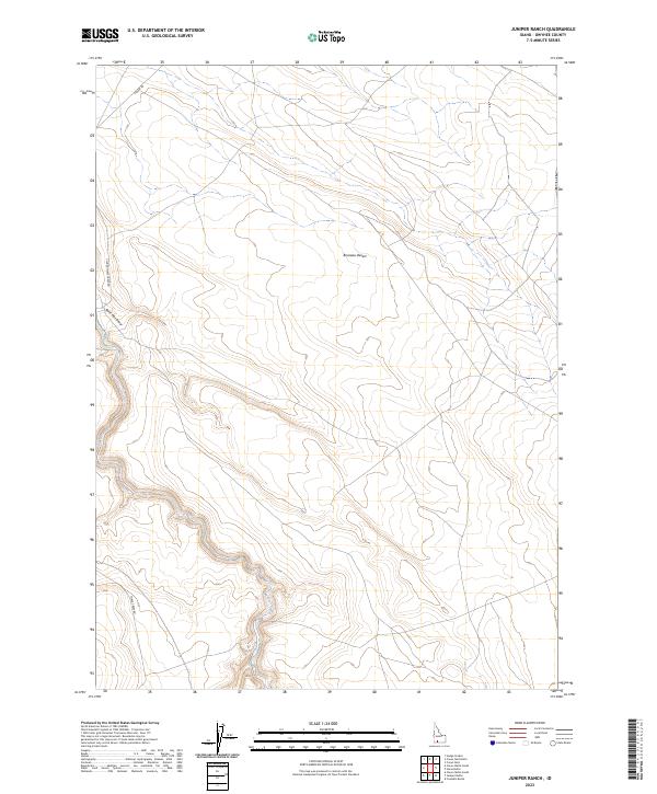
2023 Map of Juniper Ranch
USGS Topo · Published 2023About this map
The Bruneau Desert landscape of southern Owyhee County is captured here in detail by the U.S. Geological Survey. This high-plateau region is defined by its drainage patterns and isolated roadway network, where the winding course of Clover Creek carves through the southern sections. The map illustrates a remote grazing or transition landscape, with the convergence of Clover Three Creek Rd and Three Creek Rd providing the primary transit corridors through the sagebrush-covered plains. Topographic relief is most pronounced near Buck Flat Draw, revealing the erosional character of this arid environment as it was recorded in the early 2020s.
Find a feature on this map
10 named features on this map. Tap any name to fly to it.
Don’t see what you’re looking for? This feature index may not catch every label — zoom into the map to look around manually.
Map Details
Editions of this 2023 Juniper Ranch Map
This is the sole edition of this map. No revisions or reprints were ever made.
Other maps of this area

1955 · Twin Falls
USGS Topo · 1:250,000

1956 · Blue Butte
USGS Topo · 1:62,500

1958 · Twin Falls
USGS Topo · 1:250,000

1959 · Crows Nest
USGS Topo · 1:62,500

1979 · Clover Butte South
USGS Topo · 1:24,000

1979 · Coonskin Butte
USGS Topo · 1:24,000

1980 · Juniper Butte
USGS Topo · 1:24,000
1980 · Crows Nest
USGS Topo · 1:24,000

1980 · Clover Butte North
USGS Topo · 1:24,000
1980 · Juniper Ranch
USGS Topo · 1:24,000