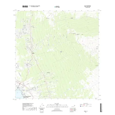
2017 Map of Kailua
USGS Topo · Published 2017About this map
The coastal settlement of Kailua anchors this survey of the western shore of the Island of Hawai'i. The landscape is defined by its volcanic geology, transitioning from the shoreline at Kamakāhonu Beach up the slopes toward the massive summit of Hualālai. Along the coast, the Ala Kahakai National Historic Trail follows the water near Kalaepa'akai and Hoolulu Cove, tracing ancient pathways through the modern residential developments of Laniākea.
Find a feature on this map
97 named features on this map. Tap any name to fly to it.
Don’t see what you’re looking for? This feature index may not catch every label — zoom into the map to look around manually.
Map Details
Editions of this 2017 Kailua Map
This is the sole edition of this map. No revisions or reprints were ever made.
Other maps of this area

1928 · Puako
USGS Topo · 1:62,500

1928 · Kailua
USGS Topo · 1:62,500

1954 · Hawaii North
USGS Topo · 1:250,000

1959 · Hawaii North
USGS Topo · 1:250,000

1959 · Kiholo
USGS Topo · 1:24,000

1959 · Hualalai
USGS Topo · 1:24,000

1959 · Puu Lehua
USGS Topo · 1:24,000

1959 · Makalawena
USGS Topo · 1:24,000

1959 · Keahole Point
USGS Topo · 1:24,000
1959 · Puu Anahulu
USGS Topo · 1:24,000