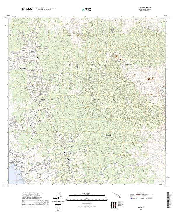
2024 Map of Kailua
USGS Topo · Published 2024About this map
The coastal settlement of Kailua anchors the western edge of this West Hawai'i survey, where the terrain rises steeply from Kailua Bay toward the upper slopes of Hualālai. The map illustrates a landscape shaped by volcanic activity, dominated by the Ka'ūpūlehu Lava Flow and the prominent Ka'ūpūlehu Crater. The distribution of inland communities like Kalaoa and Holualoa follows the contour of the Hawaii Belt Rd, reflecting the traditional importance of higher elevations for agriculture and residence away from the immediate shoreline. Numerous cultural and religious sites are preserved here, including the Saint Michaels Catholic Church and the Mauna Ziona Congregational Church, alongside educational institutions like the University of the Nations. This modern topographic study reveals the density of residential development in neighborhoods such as Kaiminani and Laniākea, contrasted against the vast undeveloped tracts of Kaloko.
Find a feature on this map
118 named features on this map. Tap any name to fly to it.
Don’t see what you’re looking for? This feature index may not catch every label — zoom into the map to look around manually.
Map Details
Editions of this 2024 Kailua Map
This is the sole edition of this map. No revisions or reprints were ever made.
Other maps of this area

1928 · Puako
USGS Topo · 1:62,500

1928 · Kailua
USGS Topo · 1:62,500

1954 · Hawaii North
USGS Topo · 1:250,000

1959 · Hawaii North
USGS Topo · 1:250,000

1959 · Kiholo
USGS Topo · 1:24,000

1959 · Hualalai
USGS Topo · 1:24,000

1959 · Puu Lehua
USGS Topo · 1:24,000

1959 · Makalawena
USGS Topo · 1:24,000

1959 · Keahole Point
USGS Topo · 1:24,000
1959 · Puu Anahulu
USGS Topo · 1:24,000