
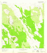
1996 Map of Kailua
USGS Topo · Published 1998About this map
The coastal settlement of Kailua and the expanding reach of Kailua-Kona anchor this mid-1990s survey of Hawaii's western slopes. Moving inland from Kailua Bay, the landscape is defined by long, narrow land divisions and homesteads such as Kalaoa-Ooma Homesteads and Kohanaiki Homesteads, which stretch toward the higher elevations of Hualalai. These tracks reflect the traditional land management systems of the region, punctuated by rugged terrain like the Kaupulehu Lava Flow. At higher altitudes, the economy shifts toward ranching and resource management, evidenced by the Hualalai Ranch and the Sheep Station located near Keauhou 2. The map also preserves the location of historic gathering spots and utilitarian sites, including the Holualoa Makai Camp and the Keopu Cemetery, providing a detailed look at the social and physical geography before more recent development altered the landscape around Palani Junction.
Find a feature on this map
78 named features on this map. Tap any name to fly to it.
Don’t see what you’re looking for? This feature index may not catch every label — zoom into the map to look around manually.
Map Details
Editions of this 1996 Kailua Map
This is the sole edition of this map. No revisions or reprints were ever made.
Other maps of this area

1928 · Puako
USGS Topo · 1:62,500

1928 · Kailua
USGS Topo · 1:62,500

1954 · Hawaii North
USGS Topo · 1:250,000

1959 · Hawaii North
USGS Topo · 1:250,000

1959 · Kiholo
USGS Topo · 1:24,000

1959 · Hualalai
USGS Topo · 1:24,000

1959 · Puu Lehua
USGS Topo · 1:24,000

1959 · Makalawena
USGS Topo · 1:24,000

1959 · Keahole Point
USGS Topo · 1:24,000
1959 · Puu Anahulu
USGS Topo · 1:24,000