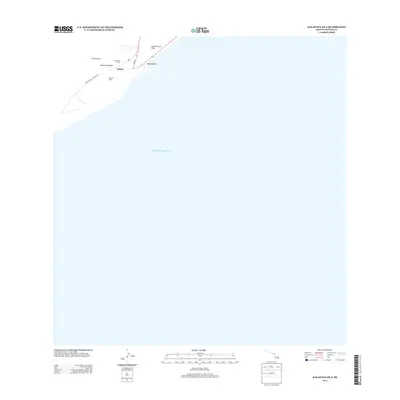
2013 Map of Kalapana OE E
USGS Topo · Published 2013About this map
Kaimū stands as a focal point along the southeastern coast of the Island of Hawai'i in this 2013 survey. The landscape is defined by its proximity to the Pacific Ocean and the physical evidence of volcanic activity, specifically the Lava Flow of 1750 that shaped the shoreline near Kalaehiamoe. This map is particularly significant for its documentation of indigenous sacred sites, including Niukukahi Heiau, Kumakaula Heiau, and Kekaloa Heiau, which provide a geographic context for cultural history. Infrastructure is centered around Kaimu-Chain of Craters Rd and Ahia Rd, reflecting the modern transit corridors that navigate this historically active geological zone.
Find a feature on this map
10 named features on this map. Tap any name to fly to it.
Don’t see what you’re looking for? This feature index may not catch every label — zoom into the map to look around manually.
Map Details
Editions of this 2013 Kalapana OE E Map
This is the sole edition of this map. No revisions or reprints were ever made.
Other maps of this area

1922 · Puna
USGS Topo · 1:62,500

1924 · Puna
USGS Topo · 1:62,500

1924 · Kalapana
USGS Topo · 1:62,500

1954 · Hawaii South
USGS Topo · 1:250,000

1959 · Hawaii South
USGS Topo · 1:250,000

1961 · Hawaii South
USGS Topo · 1:250,000

1962 · Hawaii South
USGS Topo · 1:250,000
1966 · Pahoa South
USGS Topo · 1:24,000
1966 · Kalalua
USGS Topo · 1:24,000
1966 · Kalapana
USGS Topo · 1:24,000