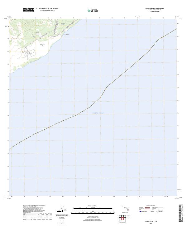
2024 Map of Kalapana OE E
USGS Topo · Published 2024About this map
Island of Hawai'i coastlines meet the vast Pacific Ocean in this topographical study of the Puna District. The landscape is defined by its volcanic history, most notably the prominent Lava Flow of 1750 that stretches toward the shore near Kaimū. Modern infrastructure, including the Pahoa-Kalapana Rd and Kaimu-Chain of Craters Rd, provides access to the coastal settlements of Kalapana and Kalaehiamoe. The mapping highlights a shoreline in transition, where roads like Alakulia and the Kalapana Kapoho Beach route trace the edge of a terrain shaped by centuries of eruptive activity. This documentation captures the intersection of residential life and the geological forces that continue to reshape the southeastern edge of the island.
Find a feature on this map
12 named features on this map. Tap any name to fly to it.
Don’t see what you’re looking for? This feature index may not catch every label — zoom into the map to look around manually.
Map Details
Editions of this 2024 Kalapana OE E Map
This is the sole edition of this map. No revisions or reprints were ever made.
Other maps of this area

1922 · Puna
USGS Topo · 1:62,500

1924 · Puna
USGS Topo · 1:62,500

1924 · Kalapana
USGS Topo · 1:62,500

1954 · Hawaii South
USGS Topo · 1:250,000

1959 · Hawaii South
USGS Topo · 1:250,000

1961 · Hawaii South
USGS Topo · 1:250,000

1962 · Hawaii South
USGS Topo · 1:250,000
1966 · Pahoa South
USGS Topo · 1:24,000
1966 · Kalalua
USGS Topo · 1:24,000
1966 · Kalapana
USGS Topo · 1:24,000