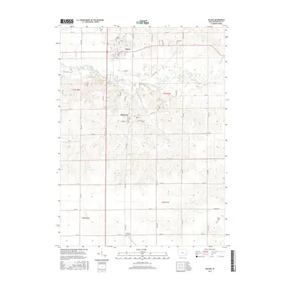
2015 Map of Kalona
USGS Topo · Published 2015About this map
The English River flows through the heart of this landscape, separating the settlement of Kalona to the north from the community of Richmond further south. This 2015 survey details a grid of rural roads named for family lineages and local flora, such as Nutmeg Ave, Larch Ave, and Poplar Blvd. For genealogists, the map is particularly useful for locating numerous small burial grounds dispersed across the townships, including Sharon Hill Cem, Richmond Cem, and the Middleburg Cemetery near the northern boundary.
Find a feature on this map
67 named features on this map. Tap any name to fly to it.
Don’t see what you’re looking for? This feature index may not catch every label — zoom into the map to look around manually.
Map Details
Editions of this 2015 Kalona Map
This is the sole edition of this map. No revisions or reprints were ever made.
Other maps of this area

1891 · Oxford
USGS Topo · 1:62,500

1891 · Iowa City
USGS Topo · 1:62,500

1894 · Oxford
USGS Topo · 1:62,500

1903 · Fairfax
USGS Topo · 1:125,000

1938 · Iowa City
USGS Topo · 1:62,500

1958 · Davenport
USGS Topo · 1:250,000

1961 · Davenport
USGS Topo · 1:250,000

1962 · Davenport
USGS Topo · 1:250,000

1965 · Williamstown
USGS Topo · 1:24,000
1965 · Hills
USGS Topo · 1:24,000