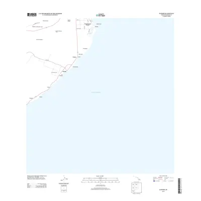
2013 Map of Kapoho
USGS Topo · Published 2013About this map
Mahinaakaka Heiau sits as a significant cultural landmark along the southeastern coast of the Island of Hawai'i, documented here just before major geological changes would alter the Puna district. This coastal landscape is defined by its volcanic history, most notably the Kii Lava Flow of 1955 which scarred the terrain north of Pohoiki. The map captures the residential layout of Vacationland Hawaii and the coastal waters at Waiopae prior to the 2018 eruptions. Inland, the topography is dominated by prominent volcanic features including Kapoho Crater and Kaholua o Kahawali Crater, while the shoreline is marked by distinct points such as Kapoho Point and Hala Point. This survey serves as a vital record of the roads and small settlements that once characterized this section of the coastline, from the village at Pualaa to the landing at Pohoiki.
Find a feature on this map
29 named features on this map. Tap any name to fly to it.
Don’t see what you’re looking for? This feature index may not catch every label — zoom into the map to look around manually.
Map Details
Editions of this 2013 Kapoho Map
This is the sole edition of this map. No revisions or reprints were ever made.
Other maps of this area

1924 · Makuu
USGS Topo · 1:62,500

1924 · Kalapana
USGS Topo · 1:62,500

1954 · Hawaii South
USGS Topo · 1:250,000

1954 · Hawaii North
USGS Topo · 1:250,000

1959 · Hawaii South
USGS Topo · 1:250,000

1959 · Hawaii North
USGS Topo · 1:250,000

1961 · Hawaii North
USGS Topo · 1:250,000

1961 · Hawaii South
USGS Topo · 1:250,000

1962 · Hawaii South
USGS Topo · 1:250,000
1965 · Pahoa North
USGS Topo · 1:24,000