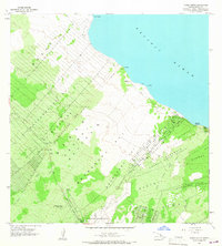
1965 Map of Pahoa North
USGS Topo · Published 1967About this map
The massive Lava Flow 1840 scars the landscape south of the Puna coast, a prominent geologic feature that still dictated land use in the mid-1960s. This survey illustrates the early residential development patterns near the Pacific Ocean, where a grid of streets like Malolo Blvd, Papio St, and Hawaiian St contrast with the rugged shoreline features of Kaloli Point and Opihi Rock. Inland, the agricultural and civic layout is anchored by the Nanawale Homesteads and Keonepoko Homesteads, showing the transition from traditional land divisions to organized settlement. A small aviation footprint is visible at the Pahoa Airstrip, while historical maritime connections are evidenced at Honolulu Landing. The map also identifies the Makuu (Site) and a Radio Facility, providing a detailed view of the Puna District before modern expansion.
Find a feature on this map
51 named features on this map. Tap any name to fly to it.
Don’t see what you’re looking for? This feature index may not catch every label — zoom into the map to look around manually.
Map Details
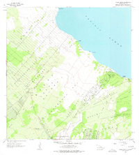
Editions of this 1965 Pahoa North Map
2 editions found
Other maps of this area

1917 · Hilo
USGS Topo · 1:62,500

1922 · Puna
USGS Topo · 1:62,500

1924 · Makuu
USGS Topo · 1:62,500

1924 · Puna
USGS Topo · 1:62,500

1924 · Kalapana
USGS Topo · 1:62,500

1932 · Hilo
USGS Topo · 1:62,500

1954 · Hawaii South
USGS Topo · 1:250,000

1954 · Hawaii North
USGS Topo · 1:250,000

1959 · Hawaii South
USGS Topo · 1:250,000

1959 · Hawaii North
USGS Topo · 1:250,000