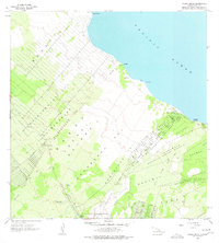
1965 Map of Pahoa North
USGS Topo · Published 1977About this map
The Kahuwa I Lava Flow dominates the southeastern terrain of this Puna District survey, illustrating the volcanic nature of the landscape near Pahoa Airstrip. Along the coast, Honolulu Landing and Kaloli Point mark the interface with the Pacific Ocean, while inland, a grid of residential and agricultural divisions defines the era's growth. The map details the Keonepoko Homesteads and Nanawale Homesteads, showing a burgeoning network of roads such as Hawaiian Blvd and Seadrift Rd north of the Nanawale Forest Reserve. Historical sites are carefully noted, including Makuu (Site) near the shore and the National Guard Reservation. This documentation provides a clear look at land tenure and subdivision patterns before significant volcanic events altered the local geography.
Find a feature on this map
49 named features on this map. Tap any name to fly to it.
Don’t see what you’re looking for? This feature index may not catch every label — zoom into the map to look around manually.
Map Details
Editions of this 1965 Pahoa North Map
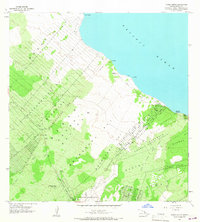
2 editions found
Other maps of this area

1917 · Hilo
USGS Topo · 1:62,500

1922 · Puna
USGS Topo · 1:62,500

1924 · Makuu
USGS Topo · 1:62,500

1924 · Puna
USGS Topo · 1:62,500

1924 · Kalapana
USGS Topo · 1:62,500

1932 · Hilo
USGS Topo · 1:62,500

1954 · Hawaii South
USGS Topo · 1:250,000

1954 · Hawaii North
USGS Topo · 1:250,000

1959 · Hawaii South
USGS Topo · 1:250,000

1959 · Hawaii North
USGS Topo · 1:250,000