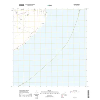
2017 Map of Kapoho
USGS Topo · Published 2017About this map
Kapoho and its surrounding coastal settlements occupy a landscape defined by volcanic activity on the eastern tip of the Island of Hawai‘i. The 2017 survey shows a network of local roads such as Kapoho Kai Dr and Kikiao Rd serving the residential area at Kahonua and the tide pools at Waiopae. The geology is prominently marked by the Kii Lava Flow of 1955, which cuts across the terrain near Kapoho Crater and Halekamahina. Along the shoreline, geographic markers like Kapoho Point and Lae o Kahuna anchor a series of small bays, including Kapoho Bay and Pohoiki Bay. This era represents the community just prior to the significant volcanic events of 2018, preserving the layout of coastal hamlets like Kalea and Lililoa.
Find a feature on this map
28 named features on this map. Tap any name to fly to it.
Don’t see what you’re looking for? This feature index may not catch every label — zoom into the map to look around manually.
Map Details
Editions of this 2017 Kapoho Map
This is the sole edition of this map. No revisions or reprints were ever made.
Other maps of this area

1924 · Makuu
USGS Topo · 1:62,500

1924 · Kalapana
USGS Topo · 1:62,500

1954 · Hawaii South
USGS Topo · 1:250,000

1954 · Hawaii North
USGS Topo · 1:250,000

1959 · Hawaii South
USGS Topo · 1:250,000

1959 · Hawaii North
USGS Topo · 1:250,000

1961 · Hawaii North
USGS Topo · 1:250,000

1961 · Hawaii South
USGS Topo · 1:250,000

1962 · Hawaii South
USGS Topo · 1:250,000
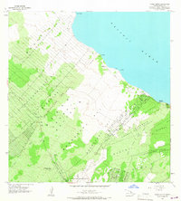
1965 · Pahoa North
USGS Topo · 1:24,000