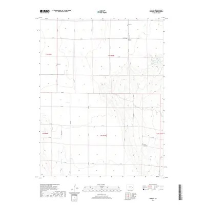
2019 Map of Karval
USGS Topo · Published 2019About this map
Karval anchors this high-plains landscape in Lincoln County, where the topography transition from flat plateaus to the incised drainage of Adobe Creek. The map provides specific genealogical value by documenting the locations of several burial sites, including the Samuel Messersmith Grave and both the Bucklen Cem and Dudley Cem. The grid-like arrangement of county roads, such as Co RD 29 and Co RD S, reveals the enduring structure of the Public Land Survey System across the prairie. Water management is a central theme of the environment, evidenced by the Karval Reservoir and the seasonal paths of Sand Arroyo and Adobe Cr. This 2019 survey documents the intersection of rural ranching routes and the sparse, vital water sources that define life on the eastern Colorado plains.
Find a feature on this map
31 named features on this map. Tap any name to fly to it.
Don’t see what you’re looking for? This feature index may not catch every label — zoom into the map to look around manually.
Map Details
Editions of this 2019 Karval Map
This is the sole edition of this map. No revisions or reprints were ever made.
Other maps of this area

1889 · Sanborn
USGS Topo · 1:125,000

1891 · Sanborn
USGS Topo · 1:125,000

1891 · Arroyo
USGS Topo · 1:125,000

1893 · Arroyo
USGS Topo · 1:125,000

1893 · Sanborn
USGS Topo · 1:125,000

1954 · Lamar
USGS Topo · 1:250,000

1958 · Lamar
USGS Topo · 1:250,000

1975 · Stanley Gulch
USGS Topo · 1:24,000

1977 · Punkin Center
USGS Topo · 1:24,000
1978 · Metz Springs
USGS Topo · 1:24,000