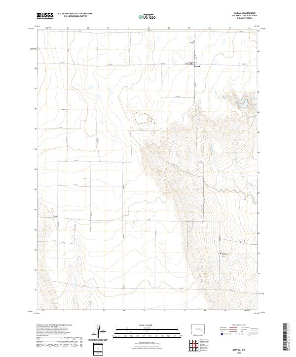
2022 Map of Karval
USGS Topo · Published 2022About this map
Karval serves as the central hub of this eastern Colorado landscape, where the High Plains topography is defined by the ephemeral drainages of Adobe Creek and the Sand Arroyo. The settlement pattern follows a rigid grid of county roads, such as Co RD S and Co RD 29, which connect isolated homesteads and ranching sites. Genealogists will find significant value in the documentation of local burial sites, including the Bucklen Cem to the north, Dudley Cem to the west, and the specific location of the Samuel Messersmith Grave in the southeastern quadrant.
Find a feature on this map
32 named features on this map. Tap any name to fly to it.
Don’t see what you’re looking for? This feature index may not catch every label — zoom into the map to look around manually.
Map Details
Editions of this 2022 Karval Map
This is the sole edition of this map. No revisions or reprints were ever made.
Other maps of this area

1889 · Sanborn
USGS Topo · 1:125,000

1891 · Sanborn
USGS Topo · 1:125,000

1891 · Arroyo
USGS Topo · 1:125,000

1893 · Arroyo
USGS Topo · 1:125,000

1893 · Sanborn
USGS Topo · 1:125,000

1954 · Lamar
USGS Topo · 1:250,000

1958 · Lamar
USGS Topo · 1:250,000

1975 · Stanley Gulch
USGS Topo · 1:24,000

1977 · Punkin Center
USGS Topo · 1:24,000
1978 · Metz Springs
USGS Topo · 1:24,000