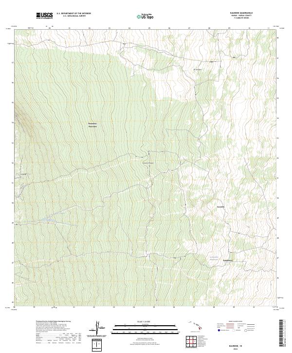
2024 Map of Kaunene
USGS Topo · Published 2024About this map
Hakalau Forest National Wildlife Refuge occupies a significant portion of this modern survey of the Island of Hawai'i. The landscape is defined by the steep elevation of the South Kona district, where local infrastructure is limited to specialized routes like Telephone Exchange Rd and Rabbit Hill Rd. The terrain shows a distinct ecological transition, moving from the forested sections of the refuge into the high-elevation volcanic slopes marked by prominent landmarks such as Pu'ukinikini and Kaunēnē. Scattered across the higher reaches are vital water sources in an otherwise arid volcanic environment, including the Komakawai Waterholes and the Ki'ilae Watercourse. The map also details the administrative and geographic reach of the Honaunau- Napoopoo region, illustrating how land management and natural conservation intersect in this contemporary Hawaiian environment.
Find a feature on this map
11 named features on this map. Tap any name to fly to it.
Don’t see what you’re looking for? This feature index may not catch every label — zoom into the map to look around manually.
Map Details
Editions of this 2024 Kaunene Map
This is the sole edition of this map. No revisions or reprints were ever made.
Other maps of this area

1927 · Kaohe
USGS Topo · 1:62,500

1928 · Kailua
USGS Topo · 1:62,500

1928 · Mauna Loa
USGS Topo · 1:62,500

1930 · Kaohe
USGS Topo · 1:62,500

1954 · Hawaii South
USGS Topo · 1:250,000

1954 · Hawaii North
USGS Topo · 1:250,000

1956 · Puu O Uo
USGS Topo · 1:24,000

1959 · Hawaii South
USGS Topo · 1:250,000

1959 · Hawaii North
USGS Topo · 1:250,000

1959 · Honaunau
USGS Topo · 1:24,000