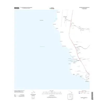
2013 Map of Keahole Point
USGS Topo · Published 2013About this map
Kona International Airport at Keahole dominates the northern shoreline of this coastal Hawai'i landscape, where modern infrastructure meets deeply rooted cultural sites. The western edge is defined by the Pacific Ocean, with jagged volcanic points such as Keahole Point and Kaiwi Point stretching into the sea. Historical layers are visible in the numerous temple sites along the coast, including Hale o Mano Heiau and Ahuena Heiau, which indicate the long-standing significance of this waterfront. The area near Honokōhau shows the transition from traditional resources like the Kaloko Fishpond to contemporary maritime activity at the Honokōhau Small Boat Harbor. Transportation routes including the Old Mamalahoa Trl and various residential drives weave through the lava fields, connecting the airport corridor to the settlements and beaches of the West Hawai'i coast.
Find a feature on this map
62 named features on this map. Tap any name to fly to it.
Don’t see what you’re looking for? This feature index may not catch every label — zoom into the map to look around manually.
Map Details
Editions of this 2013 Keahole Point Map
This is the sole edition of this map. No revisions or reprints were ever made.
Other maps of this area

1928 · Puako
USGS Topo · 1:62,500

1928 · Kailua
USGS Topo · 1:62,500

1954 · Hawaii North
USGS Topo · 1:250,000

1959 · Hawaii North
USGS Topo · 1:250,000

1959 · Kiholo
USGS Topo · 1:24,000

1959 · Makalawena
USGS Topo · 1:24,000

1959 · Keahole Point
USGS Topo · 1:24,000

1959 · Kailua
USGS Topo · 1:24,000
1960 · Kealakekua
USGS Topo · 1:24,000

1961 · Hawaii North
USGS Topo · 1:250,000