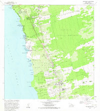
1982 Map of Kealakekua
USGS Topo · Published 1982About this map
Kamehameha Birthplace and several sacred heiau sites, including Kaukakaiaola Heiau and Keaikonawa Heiau, define the deep cultural landscape along the Kona coast as it was documented in the early 1980s. The settlement pattern follows the volcanic slopes, with population centers like Holualoa, Kainaliu, and Kealakekua concentrated along the upper road corridors above the shore. This layout highlights the mid-elevation agricultural and residential belt distinct from the coastal recreation areas around Keauhou Bay and Kahaluu Bay.
Find a feature on this map
67 named features on this map. Tap any name to fly to it.
Don’t see what you’re looking for? This feature index may not catch every label — zoom into the map to look around manually.
Map Details
Editions of this 1982 Kealakekua Map
2 editions found
Other maps of this area

1928 · Kailua
USGS Topo · 1:62,500

1954 · Hawaii South
USGS Topo · 1:250,000

1954 · Hawaii North
USGS Topo · 1:250,000

1959 · Hawaii South
USGS Topo · 1:250,000

1959 · Hawaii North
USGS Topo · 1:250,000

1959 · Hualalai
USGS Topo · 1:24,000

1959 · Honaunau
USGS Topo · 1:24,000

1959 · Puu Lehua
USGS Topo · 1:24,000

1959 · Keahole Point
USGS Topo · 1:24,000

1959 · Kailua
USGS Topo · 1:24,000