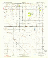
1946 Map of Kearney Park
USGS Topo · Published 1956About this map
The agricultural landscape of Fresno County unfolds across this survey, centered on the historic estate grounds of Kearney Park. Originally mapped in 1920 and updated in the post-war years, the map documents a meticulously organized grid of section lines and irrigation works essential to the Central Valley's economy. The Southern Pacific railroad corridor serves as the primary spine for commerce, supporting rural stops and small settlements like Rolinda Sta and Floyd.
Find a feature on this map
33 named features on this map. Tap any name to fly to it.
Don’t see what you’re looking for? This feature index may not catch every label — zoom into the map to look around manually.
Map Details
Editions of this 1946 Kearney Park Map
This is the sole edition of this map. No revisions or reprints were ever made.
Other maps of this area

1921 · Bullard
USGS Topo · 1:31,680

1923 · Kearney Park
USGS Topo · 1:31,680

1923 · Herndon
USGS Topo · 1:31,680

1923 · Fresno
USGS Topo · 1:31,680

1923 · Biola
USGS Topo · 1:31,680

1923 · Bullard
USGS Topo · 1:31,680

1925 · Helm
USGS Topo · 1:31,680

1925 · Raisin
USGS Topo · 1:31,680

1925 · Caruthers
USGS Topo · 1:31,680
1946 · Fresno South
USGS Topo · 1:24,000