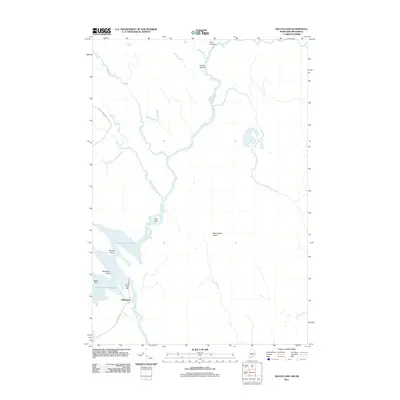
2011 Map of Kelleyland
USGS Topo · Published 2011About this map
The Saint Croix River defines the borderlands of this Maine-New Brunswick region, where the Grand Falls Dam regulates the water levels of the extensive Grand Falls Flowage. The small settlement of Kelleyland is situated at the southern edge of the flowage, serving as a focal point for local transit via Kellyland Rd. The geography is characterized by numerous islands and points along the waterway, including King Brook Island, Horse Island, and Egg Point. To the north and west, the landscape is drained by a network of tributaries such as Millberry Brook and Enoch Brook, with Enoch Brook Rd providing access through the forested interior. The map illustrates a landscape shaped by industrial water management and the natural meandering of the river system.
Find a feature on this map
17 named features on this map. Tap any name to fly to it.
Don’t see what you’re looking for? This feature index may not catch every label — zoom into the map to look around manually.
Map Details
Editions of this 2011 Kelleyland Map
This is the sole edition of this map. No revisions or reprints were ever made.
Other maps of this area

1929 · Calais
USGS Topo · 1:48,000

1932 · Calais
USGS Topo · 1:62,500

1940 · Waite
USGS Topo · 1:62,500

1940 · Kellyland
USGS Topo · 1:62,500

1941 · Big Lake
USGS Topo · 1:62,500

1942 · Kellyland
USGS Topo · 1:62,500

1942 · Waite
USGS Topo · 1:62,500

1943 · Big Lake
USGS Topo · 1:62,500

1949 · Calais
USGS Topo · 1:24,000

1952 · Big Lake
USGS Topo · 1:50,000