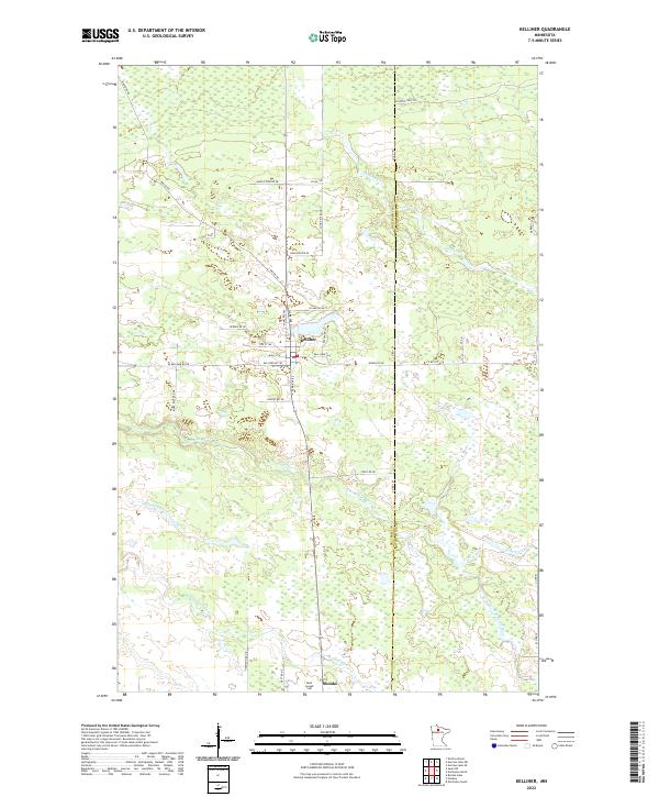
2022 Map of Kelliher
USGS Topo · Published 2022About this map
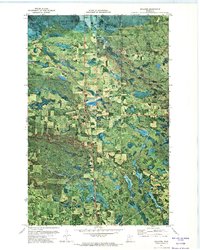
Kelliher serves as the primary hub for this Northern Minnesota landscape, where the town grid meets a complex network of wetlands and small waterways. The geography is defined by the winding paths of the S Br Battle River and the N Cormorant River, which drain through the timbered reaches of the Beltrami Co Koochiching Co boundary. To the south, the settlement of Shooks sits near the Saint Joseph Cem, while the northern portion of the quadrangle is marked by local landmarks like Hoover Cr and a dense system of unpaved forest roads. This map illustrates the intersection of small-town development and the persistent wilderness of the northern bog country, providing a clear look at the drainage patterns of Blackduck River and the rural road infrastructure like Waldo Rd.
Find a feature on this map
47 named features on this map. Tap any name to fly to it.
Don’t see what you’re looking for? This feature index may not catch every label — zoom into the map to look around manually.
Map Details
Editions of this 2022 Kelliher Map
This is the sole edition of this map. No revisions or reprints were ever made.