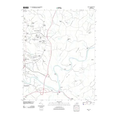
2010 Map of Kelly
USGS Topo · Published 2010About this map
The James River snakes through the center of this Virginia landscape, punctuated by Buzzard Islands and Feagans Island. Along its banks, the river's industrial and social history is visible through features like Joshua Falls, the Ninemile Bridge, and the site of the Oxford Furnace. To the north, the terrain rises toward Galts Mill Mountain and Round Mountain, while the residential expansion of Madison Heights and Lynchburg presses in from the southwest. This area is particularly dense with genealogical markers, from family and church burial grounds like Megginson Cemetery, Grace Cemetery, and Beth Joseph Agudath Sholom Cemetery to historic community hubs such as Wright Shop, Galts Mill, and Colony. The network of creeks including Stovall Creek and Archer Creek defines the local drainage, supporting old mill sites like Brightwell Mill that once anchored the rural economy of Amherst County.
Find a feature on this map
115 named features on this map. Tap any name to fly to it.
Don’t see what you’re looking for? This feature index may not catch every label — zoom into the map to look around manually.
Map Details
Editions of this 2010 Kelly Map
This is the sole edition of this map. No revisions or reprints were ever made.
Other maps of this area

1892 · Lynchburg
USGS Topo · 1:125,000

1892 · Buckingham
USGS Topo · 1:125,000

1892 · Appomattox
USGS Topo · 1:125,000

1894 · Lexington
USGS Topo · 1:125,000

1935 · Amherst
USGS Topo · 1:48,000

1939 · Amherst
USGS Topo · 1:62,500

1944 · Lynchburg
USGS Topo · 1:62,500

1947 · Roanoke
USGS Topo · 1:250,000

1950 · Amherst
USGS Topo · 1:62,500

1950 · Lynchburg
USGS Topo · 1:62,500