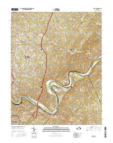
2016 Map of Kelly
USGS Topo · Published 2016About this map
The James River carves a winding path through the heart of this Central Virginia landscape, serving as the historical dividing line between Amherst, Appomattox, and Campbell counties. The topography is defined by the river’s sharp bends near Joshua Falls and the Buzzard Islands, where the elevation rises steeply toward peaks like Galts Mill Mtn and Chestnut Mtn. This area reflects a long history of industry and settlement along the water, from the site of the Oxford Furnace to the milling operations at Brightwell Mill and Galts Mill.
Find a feature on this map
166 named features on this map. Tap any name to fly to it.
Don’t see what you’re looking for? This feature index may not catch every label — zoom into the map to look around manually.
Map Details
Editions of this 2016 Kelly Map
This is the sole edition of this map. No revisions or reprints were ever made.
Other maps of this area

1892 · Lynchburg
USGS Topo · 1:125,000

1892 · Buckingham
USGS Topo · 1:125,000

1892 · Appomattox
USGS Topo · 1:125,000

1894 · Lexington
USGS Topo · 1:125,000

1935 · Amherst
USGS Topo · 1:48,000

1939 · Amherst
USGS Topo · 1:62,500

1944 · Lynchburg
USGS Topo · 1:62,500

1947 · Roanoke
USGS Topo · 1:250,000

1950 · Amherst
USGS Topo · 1:62,500

1950 · Lynchburg
USGS Topo · 1:62,500