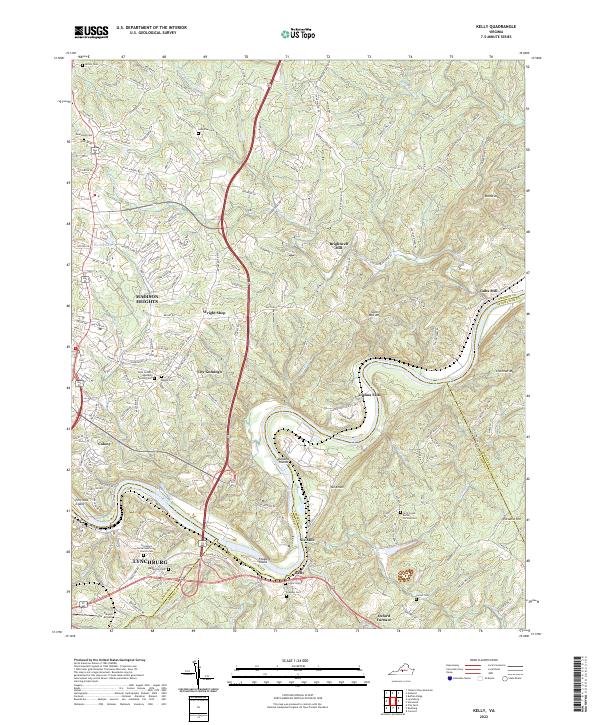
2022 Map of Kelly
USGS Topo · Published 2022About this map
The James River carves a deep loop through this landscape, marking the convergence of Amherst, Appomattox, and Campbell Counties. The northern bank is anchored by the industrial and residential growth of Madison Heights, while the southern reaches of Lynchburg appear along the river's bend near Percivals Island. This section of the river valley is historically defined by the transport and milling economy of the Piedmont, evidenced by several named landmarks such as Brightwell Mill, Galts Mill, and the early industrial site at Oxford Furnace. Significant genealogical resources are scattered throughout the quadrangle, including the Tyreeanna United Methodist Church Cem and the Arch Creek Burial Society Cem. The terrain is characterized by prominent heights like Mt Athos and Galts Mill Mtn, which overlook the river's winding path past Buzzard Islands and Feagans Island.
Find a feature on this map
171 named features on this map. Tap any name to fly to it.
Don’t see what you’re looking for? This feature index may not catch every label — zoom into the map to look around manually.
Map Details
Editions of this 2022 Kelly Map
This is the sole edition of this map. No revisions or reprints were ever made.
Other maps of this area

1892 · Lynchburg
USGS Topo · 1:125,000

1892 · Buckingham
USGS Topo · 1:125,000

1892 · Appomattox
USGS Topo · 1:125,000

1894 · Lexington
USGS Topo · 1:125,000

1935 · Amherst
USGS Topo · 1:48,000

1939 · Amherst
USGS Topo · 1:62,500

1944 · Lynchburg
USGS Topo · 1:62,500

1947 · Roanoke
USGS Topo · 1:250,000

1950 · Amherst
USGS Topo · 1:62,500

1950 · Lynchburg
USGS Topo · 1:62,500