
1942 Map of Kellyland
USGS Topo · Published 1942About this map
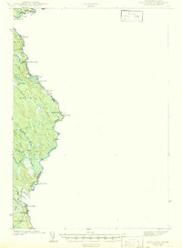
The St Croix River serves as the central artery and international boundary throughout this 1940 survey, separating Maine and New Brunswick. The landscape is defined by the river’s descent through numerous whitewater stretches, including Tyler Rips, Rocky Rips, and Meetinghouse Rips. Industrial activity is centered at the southern edge of the map at Kellyland and Grand Falls, where the river’s power was harnessed for the local economy in Baileyville.
Find a feature on this map
31 named features on this map. Tap any name to fly to it.
Don’t see what you’re looking for? This feature index may not catch every label — zoom into the map to look around manually.
Map Details
Editions of this 1942 Kellyland Map
2 editions found
Other maps of this area

1929 · Calais
USGS Topo · 1:48,000

1929 · Robbinston
USGS Topo · 1:48,000

1930 · Vanceboro
USGS Topo · 1:48,000

1931 · Robbinston
USGS Topo · 1:62,500

1932 · Calais
USGS Topo · 1:62,500

1933 · Vanceboro
USGS Topo · 1:62,500

1940 · Waite
USGS Topo · 1:62,500

1940 · Forest
USGS Topo · 1:62,500

1940 · Kellyland
USGS Topo · 1:62,500

1941 · Big Lake
USGS Topo · 1:62,500