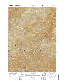
2014 Map of Kelsey Peak
USGS Topo · Published 2014About this map
The Rogue River carves a deep path through this section of the Siskiyou National Forest along the border of Josephine and Curry counties. This 2014 survey documents a series of river bars and technical water features that have long defined travel in this wilderness, including Missouri Bar, Winkle Bar, and Battle Bar. The presence of the Winkle Bar Airport highlights the necessity of aerial access in this road-sparse terrain, while numerous named riffles like Johns Riffle and Magpies Riffle indicate the river's navigational hazards. Away from the water, the topography rises sharply to landmarks such as Kelsey Peak and Bear Camp Ridge. The map also captures several forest access routes like Bruin Spur and Marial Rdg, which navigate the steep elevations between Big Meadows and the river canyon below.
Find a feature on this map
53 named features on this map. Tap any name to fly to it.
Don’t see what you’re looking for? This feature index may not catch every label — zoom into the map to look around manually.
Map Details
Editions of this 2014 Kelsey Peak Map
This is the sole edition of this map. No revisions or reprints were ever made.
Other maps of this area

1946 · Galice
USGS Topo · 1:62,500

1946 · Dutchman Butte
USGS Topo · 1:62,500

1948 · Galice
USGS Topo · 1:62,500

1948 · Dutchman Butte
USGS Topo · 1:62,500

1954 · Bone Mountain
USGS Topo · 1:62,500

1954 · Marial
USGS Topo · 1:62,500

1955 · Medford
USGS Topo · 1:250,000

1957 · Medford
USGS Topo · 1:250,000

1958 · Medford
USGS Topo · 1:250,000
1989 · Hobson Horn
USGS Topo · 1:24,000