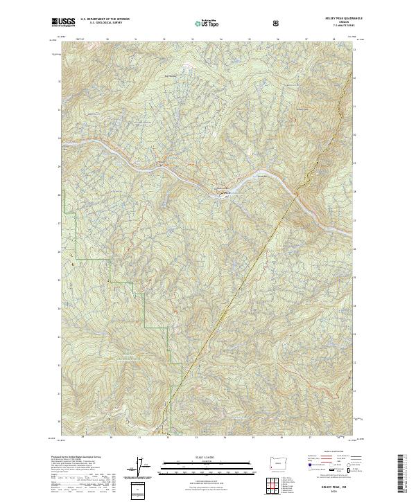
2023 Map of Kelsey Peak
USGS Topo · Published 2023About this map
Rogue River rapids and bars dominate this portion of the Siskiyou National Forest along the boundary of Curry and Josephine counties. The landscape is defined by the steep drainage basins of Mule Creek, Kelsey Creek, and Big Windy Creek, where the river cuts through the Wild Rogue Wilderness. Historically significant river crossings and landing sites are documented, including Missouri Bar, China Bar, and Winkle Bar.
Find a feature on this map
47 named features on this map. Tap any name to fly to it.
Don’t see what you’re looking for? This feature index may not catch every label — zoom into the map to look around manually.
Map Details
Editions of this 2023 Kelsey Peak Map
This is the sole edition of this map. No revisions or reprints were ever made.
Other maps of this area

1946 · Galice
USGS Topo · 1:62,500

1946 · Dutchman Butte
USGS Topo · 1:62,500

1948 · Galice
USGS Topo · 1:62,500

1948 · Dutchman Butte
USGS Topo · 1:62,500

1954 · Bone Mountain
USGS Topo · 1:62,500

1954 · Marial
USGS Topo · 1:62,500

1955 · Medford
USGS Topo · 1:250,000

1957 · Medford
USGS Topo · 1:250,000

1958 · Medford
USGS Topo · 1:250,000
1989 · Hobson Horn
USGS Topo · 1:24,000