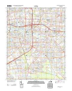
2013 Map of Kempsville
USGS Topo · Published 2013About this map
The Eastern Branch Elizabeth River and its various tributaries, including Broad Creek and Indian River, anchor this detailed 2013 snapshot of Virginia's Tidewater region. The landscape is characterized by its high-density residential development, where long-established neighborhoods like Pembroke Manor, Poplar Halls, and Aragona Village are woven between complex water systems. Land use varies from the academic environment of College Park to the recreational corridors of the Greenbrier Golf Course and Stumpy Lake Golf Course.
Find a feature on this map
382 named features on this map. Tap any name to fly to it.
Don’t see what you’re looking for? This feature index may not catch every label — zoom into the map to look around manually.
Map Details
Editions of this 2013 Kempsville Map
This is the sole edition of this map. No revisions or reprints were ever made.
Other maps of this area

1907 · Norfolk
USGS Topo · 1:125,000

1918 · Cape Henry
USGS Topo · 1:62,500

1919 · Cape Henry
USGS Topo · 1:62,500

1921 · Newport News
USGS Topo · 1:62,500

1939 · Moyock
USGS Topo · 1:62,500

1940 · Lake Drummond
USGS Topo · 1:62,500

1944 · Norfolk South
USGS Topo · 1:25,000

1945 · Lake Drummond
USGS Topo · 1:62,500

1946 · Moyock
USGS Topo · 1:62,500

1948 · Norfolk South
USGS Topo · 1:24,000