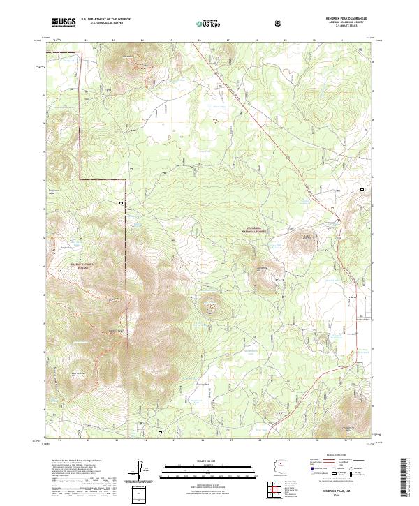
2021 Map of Kendrick Peak
USGS Topo · Published 2021About this map
Kendrick Peak dominates this volcanic landscape, with a dense network of trails and water management features serving the higher elevations. The boundary between Kaibab National Forest and Coconino National Forest bisects the area, highlighting a managed wilderness where topography dictates usage. Water is scarce, evidenced by the numerous named tanks such as Mudersbach Tank, Crowley Tank, and Secelid Tank, which are critical for both wildlife and livestock in this high-altitude environment.
Find a feature on this map
51 named features on this map. Tap any name to fly to it.
Don’t see what you’re looking for? This feature index may not catch every label — zoom into the map to look around manually.
Map Details
Editions of this 2021 Kendrick Peak Map
This is the sole edition of this map. No revisions or reprints were ever made.
Other maps of this area

1886 · San Francisco Mtns
USGS Topo · 1:250,000

1891 · San Francisco Mtns
USGS Topo · 1:250,000

1894 · San Francisco Mtns
USGS Topo · 1:250,000

1899 · San Francisco Mtns
USGS Topo · 1:250,000

1908 · Flagstaff
USGS Topo · 1:125,000

1912 · Flagstaff
USGS Topo · 1:125,000

1947 · Flagstaff
USGS Topo · 1:250,000

1954 · Flagstaff
USGS Topo · 1:250,000

1958 · Flagstaff
USGS Topo · 1:250,000

1960 · Flagstaff
USGS Topo · 1:250,000