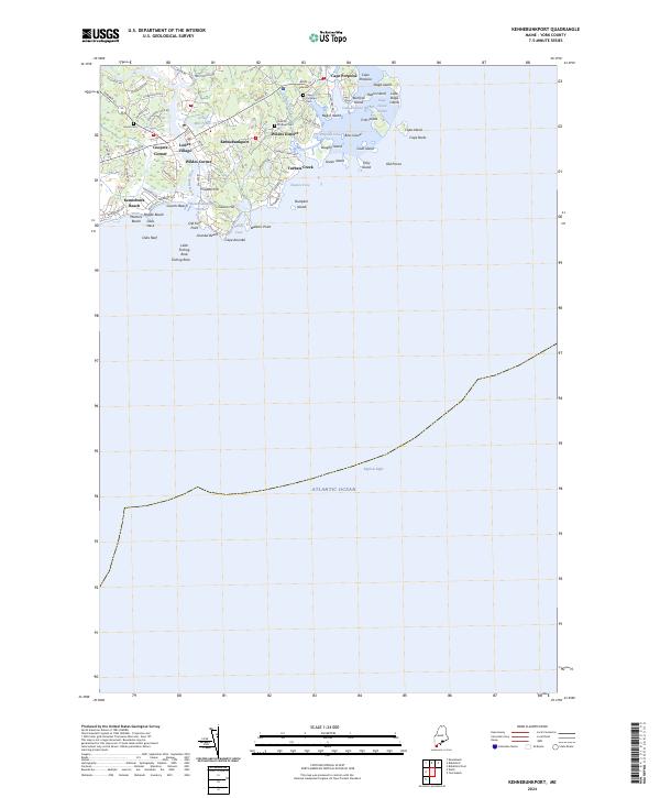
2024 Map of Kennebunkport
USGS Topo · Published 2024About this map
Kennebunkport and its surrounding coastal districts are defined by a complex network of tidal inlets, rocky necks, and historic harbors. The settlement pattern moves inland from the Kennebunkport Harbor through the Lower Village toward Coopers Corner, while the eastern shoreline remains dotted with islands such as Stage Island and Trott Island. Local history is anchored by several family-named landmarks and resting places, including the Cape Porpoise Cem and the small Dobson Cem near Wildes District. This coastal area shows the intersection of maritime heritage and modern geography, where the Kennebunk River flows past Grist Mill Pond to reach the sea at Arundel Beach. Prominent features like Walkers Point and Cape Arundel emphasize the area's geological character, characterized by jagged peninsulas and sheltered coves like Sandy Cove that have supported the local economy and culture for generations.
Find a feature on this map
77 named features on this map. Tap any name to fly to it.
Don’t see what you’re looking for? This feature index may not catch every label — zoom into the map to look around manually.
Map Details
Editions of this 2024 Kennebunkport Map
This is the sole edition of this map. No revisions or reprints were ever made.
Other maps of this area

1891 · Biddeford
USGS Topo · 1:62,500

1891 · Kennebunk
USGS Topo · 1:62,500

1893 · Kennebunk
USGS Topo · 1:62,500

1893 · York
USGS Topo · 1:62,500

1893 · Biddeford
USGS Topo · 1:62,500

1898 · Kennebunk
USGS Topo · 1:62,500

1920 · York
USGS Topo · 1:62,500

1941 · Biddeford
USGS Topo · 1:62,500

1941 · Kennebunk
USGS Topo · 1:62,500

1944 · Wells
USGS Topo · 1:24,000