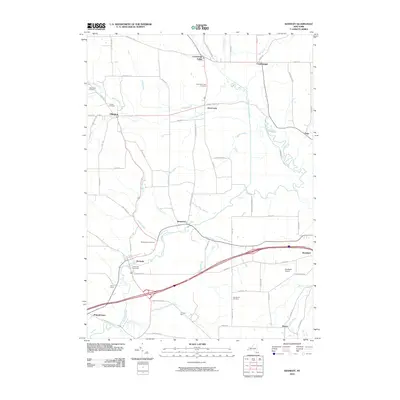
2010 Map of Kennedy
USGS Topo · Published 2010About this map
Conewango Creek and its many tributaries, including Twentyeighth Creek and Indian Brook, define the drainage of this Chautauqua and Cattaraugus County borderland. In this early 21st-century landscape, the village of Kennedy serves as a local hub near the intersection of several regional roads, while smaller hamlets like ClearCreek and Waterboro preserve the quiet character of the western New York countryside. The map reveals a high concentration of burial grounds, such as Pioneer Cemetery and Valley View Cemetery, which provide significant points of interest for those tracing early families in the Ellington area. Modern transportation is represented by the southern expressway corridor passing near Randolph and the Randolph Airport, yet the presence of legacy names like Schermerhorn Corners and Ormond Farm speaks to the enduring agricultural roots and family landmarks that have shaped these valleys for generations.
Find a feature on this map
74 named features on this map. Tap any name to fly to it.
Don’t see what you’re looking for? This feature index may not catch every label — zoom into the map to look around manually.
Map Details
Editions of this 2010 Kennedy Map
This is the sole edition of this map. No revisions or reprints were ever made.
Other maps of this area

1900 · Cherry Creek
USGS Topo · 1:62,500

1905 · Jamestown
USGS Topo · 1:62,500

1922 · Randolph
USGS Topo · 1:62,500

1923 · Randolph
USGS Topo · 1:62,500

1923 · Cattaraugus
USGS Topo · 1:62,500

1938 · Cattaraugus
USGS Topo · 1:62,500

1941 · Cattaraugus
USGS Topo · 1:62,500

1941 · Cherry Creek
USGS Topo · 1:62,500

1942 · Jamestown
USGS Topo · 1:62,500

1943 · Randolph
USGS Topo · 1:62,500