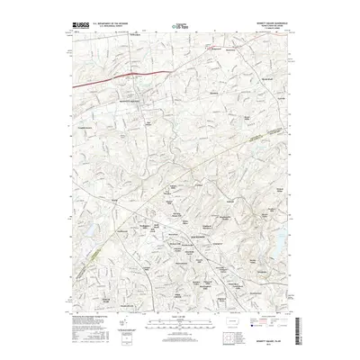
2016 Map of Kennett Square
USGS Topo · Published 2016About this map
Kennett Square and Hockessin anchor this portrait of the rolling borderlands between Chester County, Pennsylvania, and New Castle County, Delaware. The landscape is defined by the complex drainage of the W Br Red Clay Cr and E Br Red Clay Cr, which converge as Red Clay Creek flows south toward the Hoopes Reservoir. The map reveals a dense network of suburban growth and historical crossroads, where smaller communities like Willowdale, Hamorton, and Yorklyn sit amidst numerous named developments such as Auburn Hills and Gateway Farms. Genealogists will find the locations of the Union Hill Cem, Saint Patrick Cem, and Longwood Cem particularly useful for identifying family sites near Longwood. Local infrastructure is represented by Whittle Airport and the Kennett Square Reservoir, illustrating the transition of these traditional agricultural and mill lands into a modern residential corridor.
Find a feature on this map
268 named features on this map. Tap any name to fly to it.
Don’t see what you’re looking for? This feature index may not catch every label — zoom into the map to look around manually.
Map Details
Editions of this 2016 Kennett Square Map
This is the sole edition of this map. No revisions or reprints were ever made.
Other maps of this area

1898 · Elkton
USGS Topo · 1:62,500

1900 · Elkton
USGS Topo · 1:62,500

1901 · West Chester
USGS Topo · 1:62,500

1904 · West Chester
USGS Topo · 1:62,500

1904 · Coatesville
USGS Topo · 1:62,500

1904 · Wilmington
USGS Topo · 1:62,500

1906 · Coatesville
USGS Topo · 1:62,500

1906 · Wilmington
USGS Topo · 1:62,500

1917 · Elkton
USGS Topo · 1:62,500

1918 · Coatesville
USGS Topo · 1:62,500
Featured Places
- Hockessin, DE
- New Garden Township, PA
- Kennett Square, PA
- Willowdale, East Marlborough Township
- Pennsbury Township, PA