2024 Map of Keo
USGS Topo · Published 2024About this map
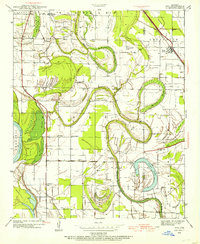
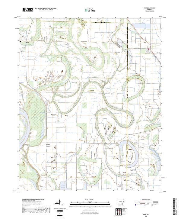
Keo and its surrounding agricultural plains define this section of the Arkansas Delta along the Lonoke and Pulaski County line. The landscape is heavily influenced by its hydrologic history, marked by meandering bayous and stagnant brakes like McNeely Brake, Morris Brake, and the winding Beaverdam Bayou. These water features, alongside LaBelle Bayou and Wabbaseka Bayou, dictate the placement of local roads and farm boundaries. Small rural centers and named locales such as Wampoo, Bredlow Corner, and Estes anchor the community, while the Bredlow Farm Airport and Bredlow Reservoir highlight the intersection of local aviation and water management in the region. The geography is largely flat, save for the distinct Rounded Hill near North Bayou.
Find a feature on this map
63 named features on this map. Tap any name to fly to it.
Don’t see what you’re looking for? This feature index may not catch every label — zoom into the map to look around manually.
Map Details
Editions of this 2024 Keo Map
This is the sole edition of this map. No revisions or reprints were ever made.
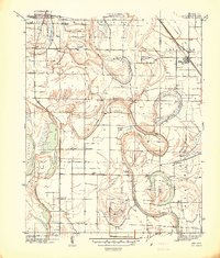
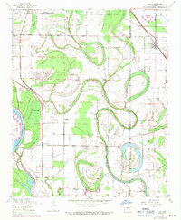
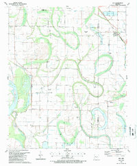
Historical Maps of Keo Through Time
5 maps found