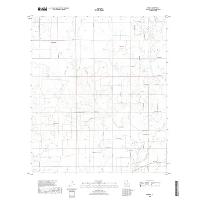
2018 Map of Kernan
USGS Topo · Published 2018About this map
Kernan sits in the lower reaches of this Beauregard Parish landscape, characterized by a complex network of bayous, gullies, and creeks that define the local drainage patterns. The terrain is marked by distinct water features such as Bull Bayou and Big Gully, while Mayhaw Glade suggests the low-lying, seasonally wet environments common to this portion of Louisiana. A dense web of parish and family-named roads, including Wesley Coleman Rd, Esco Rigmaiden Rd, and Tom Bruce Rd, provides evidence of long-standing rural settlement and land division. These thoroughfares connect scattered homesites across the townships of t5s r10w, t5s r9w, t6s r10w, and t6s r9w, where the hydrology of Cowpen Cr and Hickory Branch continues to shape the agricultural and residential footprint of the parish.
Find a feature on this map
61 named features on this map. Tap any name to fly to it.
Don’t see what you’re looking for? This feature index may not catch every label — zoom into the map to look around manually.
Map Details
Editions of this 2018 Kernan Map
This is the sole edition of this map. No revisions or reprints were ever made.
Other maps of this area

1935 · Gordon
USGS Topo · 1:31,680

1935 · Gaytine
USGS Topo · 1:31,680

1935 · Longville
USGS Topo · 1:31,680

1947 · Singer
USGS Topo · 1:31,680

1947 · Gaytine
USGS Topo · 1:31,680

1947 · DeQuincy
USGS Topo · 1:31,680

1947 · Oretta
USGS Topo · 1:31,680

1947 · Kernan
USGS Topo · 1:31,680

1947 · Longville
USGS Topo · 1:31,680

1947 · Beckwith School
USGS Topo · 1:31,680