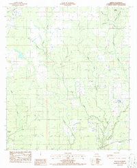
1986 Map of Kernan
USGS Topo · Published 1986About this map
Kernan and the surrounding reaches of Beauregard Parish are defined by a complex drainage network that dictated the early footprint of this Louisiana landscape. The map details the winding courses of Bull Bayou and Cole Creek, alongside numerous tributaries like Big Gully and Wild Cow Creek. Small settlements such as Poley and Greenhead anchor the rural sections of the parish during the mid-1980s. While much of the area remained heavily wooded or swampy, the presence of an Oil Refinery and a Gravel Pit indicates the specific industrial drivers of the local economy. This survey documents the transition between the wilder waterways and the established rural roads that connected these isolated Louisiana communities during this era.
Find a feature on this map
18 named features on this map. Tap any name to fly to it.
Don’t see what you’re looking for? This feature index may not catch every label — zoom into the map to look around manually.
Map Details
Editions of this 1986 Kernan Map
This is the sole edition of this map. No revisions or reprints were ever made.
Other maps of this area

1935 · Gordon
USGS Topo · 1:31,680

1935 · Gaytine
USGS Topo · 1:31,680

1935 · Longville
USGS Topo · 1:31,680

1947 · Singer
USGS Topo · 1:31,680

1947 · Gaytine
USGS Topo · 1:31,680

1947 · DeQuincy
USGS Topo · 1:31,680

1947 · Oretta
USGS Topo · 1:31,680

1947 · Kernan
USGS Topo · 1:31,680

1947 · Longville
USGS Topo · 1:31,680

1947 · Beckwith School
USGS Topo · 1:31,680