2022 Map of Kerrick
USGS Topo · Published 2022About this map
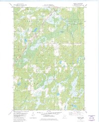
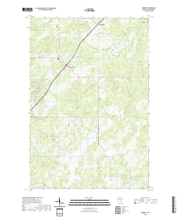
Kerrick and the neighboring settlement of Duquette anchor this portion of northern Pine County, where the landscape is defined by the headwaters and tributaries of several prominent regional drainage systems. The northern reaches are shaped by the Willow River and Walthausen Lake, while the central area around Kerrick is marked by Hicks Lake and the winding course of the Little Willow River. For those researching local family history, Saint Michaels Cem is a notable landmark situated just north of the Kerrick townsite.
Find a feature on this map
36 named features on this map. Tap any name to fly to it.
Don’t see what you’re looking for? This feature index may not catch every label — zoom into the map to look around manually.
Map Details
Editions of this 2022 Kerrick Map
This is the sole edition of this map. No revisions or reprints were ever made.