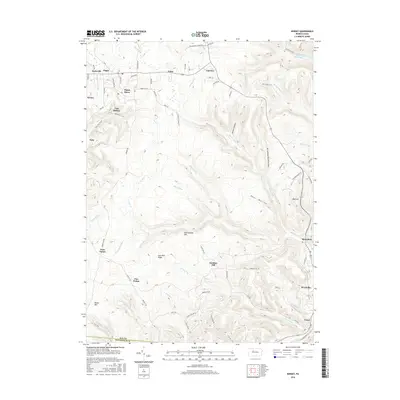
2016 Map of Kersey
USGS Topo · Published 2016About this map
Dagus Mines and the surrounding Elk County settlements form the heart of this landscape, reflecting a long history of resource extraction and hilltop habitation. Small communities like Coal Hollow, Earlyville, and Byrnedale are situated along the winding drainage of Little Toby Cr and Byrnes Run. The map illustrates a distinct settlement pattern where clusters of homes and mines are interconnected by mountain roads such as Skyline Dr and the Old Shawnut Grade Rd. To the northeast, the Wolf Lick Reservoir sits near the headwaters of Wolf Lick Run, while the southern terrain is dominated by the broad heights of Boone Mtn and Jack Pine Ridge. This survey provides a modern look at the industrial legacy of the region, from the valley floor at Weedville to the isolated clearing of Bear Wallow.
Find a feature on this map
89 named features on this map. Tap any name to fly to it.
Don’t see what you’re looking for? This feature index may not catch every label — zoom into the map to look around manually.
Map Details
Editions of this 2016 Kersey Map
This is the sole edition of this map. No revisions or reprints were ever made.
Other maps of this area

1929 · Clearfield
USGS Topo · 1:48,000

1929 · Penfield
USGS Topo · 1:62,500

1932 · Clearfield
USGS Topo · 1:62,500

1932 · Penfield
USGS Topo · 1:62,500

1941 · Benezette
USGS Topo · 1:62,500

1941 · Ridgway
USGS Topo · 1:62,500

1943 · Benezette
USGS Topo · 1:62,500

1944 · Ridgway
USGS Topo · 1:62,500

1957 · Warren
USGS Topo · 1:250,000

1958 · Warren
USGS Topo · 1:250,000