2023 Map of Kersey
USGS Topo · Published 2023About this map
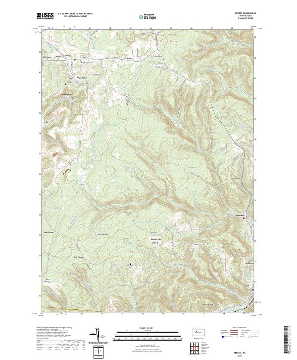
The ridge and valley landscape of Elk County is defined here by the winding course of the Bennett Branch Sinnemahoning Creek and its many tributaries, including Dagusca-honda Run and Little Toby Creek. In this region, early coal mining roots are evident in place names like Coal Hollow and Dagus Mines, while the tight-knit character of these mountain communities is preserved through numerous rural burial grounds such as Elkton Cem, Maria Lutheran Cem, and the Gardner Hill Cem. High elevations like Boone Mountain and Jack Pine Ridge partition the landscape, influencing the placement of settlements like Kersey and Byrnedale along the valley floors. These patterns illustrate a historical dependence on the local drainage systems and narrow corridors of the Allegheny Plateau, connecting remote hamlets like Scattertown to the larger centers of Weedville and Force.
Find a feature on this map
104 named features on this map. Tap any name to fly to it.
Don’t see what you’re looking for? This feature index may not catch every label — zoom into the map to look around manually.
Map Details
Editions of this 2023 Kersey Map
This is the sole edition of this map. No revisions or reprints were ever made.
Historical Maps of Paine Through Time
Featured Locations
- Jay Township, PA
- Force, Jay Township
- Fairview, Fox Township
- Five Points, Fox Township
- Four Points, Fox Township