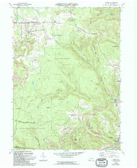
1970 Map of Kersey
USGS Topo · Published 1994About this map
Dagus Mines and the village of Kersey anchor this study of the Pennsylvania coalfields, where the extraction of natural resources has visibly reshaped the landscape. The map highlights extensive industrial activity through numerous labels for Strip Mine and Reclaimed Strip Mine operations, particularly around Coal Hollow and Gardner Hill. This industrial footprint is contrasted by the protected expanses of the Elk State Forest and Moshannon State Forest, which cover much of the high ground between Boone Mtn and Jack Pine Ridge.
Find a feature on this map
50 named features on this map. Tap any name to fly to it.
Don’t see what you’re looking for? This feature index may not catch every label — zoom into the map to look around manually.
Map Details
Editions of this 1970 Kersey Map
3 editions found
Other maps of this area

1929 · Clearfield
USGS Topo · 1:48,000

1929 · Penfield
USGS Topo · 1:62,500

1932 · Clearfield
USGS Topo · 1:62,500

1932 · Penfield
USGS Topo · 1:62,500

1941 · Benezette
USGS Topo · 1:62,500

1941 · Ridgway
USGS Topo · 1:62,500

1943 · Benezette
USGS Topo · 1:62,500

1944 · Ridgway
USGS Topo · 1:62,500

1957 · Warren
USGS Topo · 1:250,000

1958 · Warren
USGS Topo · 1:250,000
Featured Places
- Fox Township, PA
- Coal Hollow, Fox Township
- Kersey, Fox Township
- Dagus Mines, Fox Township
- Jay Township, PA