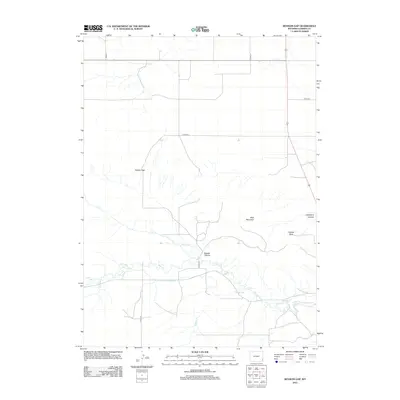
2012 Map of Kessler Gap
USGS Topo · Published 2012About this map
Kessler Gap and the high point of Bear Mountain define this stretch of the Wyoming-Nebraska borderlands in Goshen County. This 2012 survey highlights an arid landscape shaped by vital irrigation infrastructure, tracing the paths of the Kessler Ditch, Bear Creek Ditch, and Lovercheck Ditch as they divert water across the plains. The terrain is marked by distinctive natural landmarks including Squaw Rock and Atterbury Canyon, alongside seasonal watercourses like Fox Cr and Badger Br. The map also documents the local road network through Road 31 and several county roads such as Co Rd-225, reflecting the rural character and land management patterns of this High Plains region. The presence of Kessler Canyon further emphasizes the varied topography between the flat rangelands and rising bluffs.
Find a feature on this map
17 named features on this map. Tap any name to fly to it.
Don’t see what you’re looking for? This feature index may not catch every label — zoom into the map to look around manually.
Map Details
Editions of this 2012 Kessler Gap Map
This is the sole edition of this map. No revisions or reprints were ever made.
Other maps of this area

1899 · Goshen Hole
USGS Topo · 1:125,000

1954 · Cheyenne
USGS Topo · 1:250,000

1958 · Cheyenne
USGS Topo · 1:250,000

1960 · Diamond Flat
USGS Topo · 1:24,000

1960 · Petsch Reservoir
USGS Topo · 1:24,000

1960 · Hawk Springs
USGS Topo · 1:24,000

1960 · Needle Rock
USGS Topo · 1:24,000

1960 · Rocky Hollow
USGS Topo · 1:24,000

1960 · Kessler Gap
USGS Topo · 1:24,000

1960 · Meriden
USGS Topo · 1:24,000