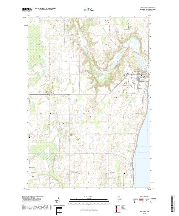
2022 Map of Kewaunee
USGS Topo · Published 2022About this map
The Kewaunee County Courthouse stands as a central landmark in the lakeside port of Kewaunee, where the Kewaunee River meets Lake Michigan. This coastal landscape is defined by the winding river valley and the presence of significant recreational corridors, including the Ice Age National Scenic Trl and the Ahnapee State Trl. Outside the town center, smaller settlements like Birchwood and East Krok dot the rural interior, which is characterized by several water bodies such as Stump Pond and Seidel Lake. The density of cemeteries across this map, from Saint Hedwigs Catholic Cem in the west to Forest Hill Cem in the south, provides a clear record of early rural parishes and family burial sites. The presence of Lipsky Swamp and several creeks like Thorn Apple Cr indicates a varied wetland environment that has influenced the layout of local roads such as Krok Rd and Townline Rd.
Find a feature on this map
55 named features on this map. Tap any name to fly to it.
Don’t see what you’re looking for? This feature index may not catch every label — zoom into the map to look around manually.
Map Details
Editions of this 2022 Kewaunee Map
This is the sole edition of this map. No revisions or reprints were ever made.
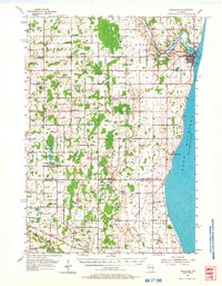
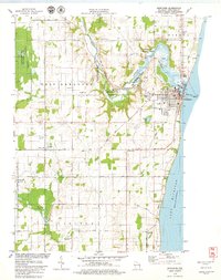
Historical Maps of Kewaunee Through Time
3 maps found