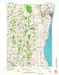
1954 Map of Kewaunee
USGS Topo · Published 1967About this map
The Kewaunee River winds through the heart of this coastal Wisconsin landscape, meeting the shores of Lake Michigan at the city of Kewaunee. In the mid-1950s, the rural countryside was densely populated with small crossroad communities and a remarkable network of local educational and religious institutions. Settlements like Pilsen, Stangelville, and Tisch Mills anchor the agricultural interior, while the Green Bay and Western Railroad provides a vital transportation link through the northern portion of the quadrangle.
Find a feature on this map
80 named features on this map. Tap any name to fly to it.
Don’t see what you’re looking for? This feature index may not catch every label — zoom into the map to look around manually.
Map Details
Editions of this 1954 Kewaunee Map
2 editions found
Other maps of this area

1952 · Casco
USGS Topo · 1:62,500

1954 · Kewaunee
USGS Topo · 1:62,500

1954 · Manitowoc
USGS Topo · 1:62,500

1954 · Denmark
USGS Topo · 1:62,500

1954 · New Franken
USGS Topo · 1:62,500

1954 · Reedsville
USGS Topo · 1:62,500

1954 · Manitowoc
USGS Topo · 1:250,000

1958 · Manitowoc
USGS Topo · 1:250,000

1960 · Algoma
USGS Topo · 1:62,500

1978 · Casco
USGS Topo · 1:24,000