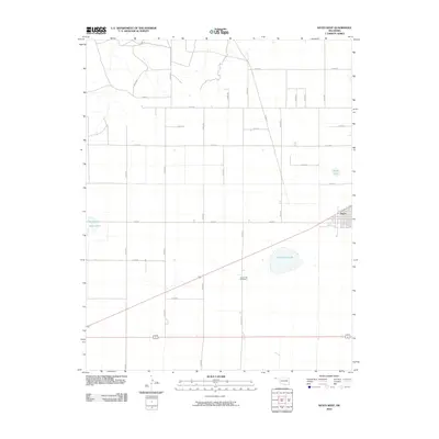
2010 Map of Keyes West
USGS Topo · Published 2010About this map
Keyes anchors the eastern edge of this Oklahoma panhandle landscape, where the town's residential grid meets the intersection of major regional routes and the railroad. The surrounding terrain is defined by a strict section-line road network, including n0420 RD and e0140 RD, which service the agricultural parcels of Cimarron County. A notable point of historical interest is the Willow Bar Cemetery, situated near the intermittent waters of Willow Bar Lake. This landscape is dotted with several significant local basins, such as Castor Lake in the west and Slimp Lake to the northeast, which provide critical landmarks in an area dominated by large-scale farming and grazing. The alignment of the railroad through the center of Keyes illustrates the town's enduring role as a transport hub for the local grain and cattle economy.
Find a feature on this map
27 named features on this map. Tap any name to fly to it.
Don’t see what you’re looking for? This feature index may not catch every label — zoom into the map to look around manually.
Map Details
Editions of this 2010 Keyes West Map
This is the sole edition of this map. No revisions or reprints were ever made.
Other maps of this area

1954 · Dalhart
USGS Topo · 1:250,000

1958 · Dalhart
USGS Topo · 1:250,000

1962 · Dalhart
USGS Topo · 1:250,000

1971 · Keyes SW
USGS Topo · 1:24,000

1971 · Keyes West
USGS Topo · 1:24,000

1971 · Keyes NW
USGS Topo · 1:24,000

1971 · Keyes NE
USGS Topo · 1:24,000

1971 · Sampsel Lake
USGS Topo · 1:24,000

1971 · Conrad NW
USGS Topo · 1:24,000

1971 · Keyes East
USGS Topo · 1:24,000