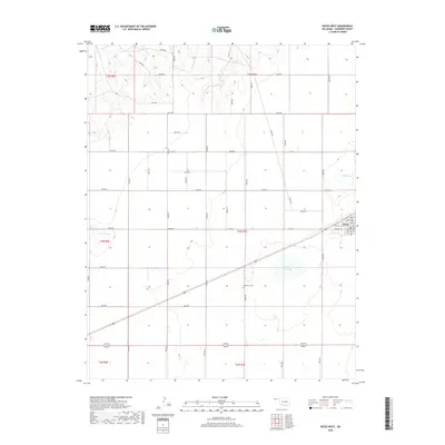
2018 Map of Keyes West
USGS Topo · Published 2018About this map
Keyes sits at the eastern edge of this high plains landscape in the Oklahoma Panhandle, where the town's street grid, including 2nd St and Ramsey Blvd, meets the open section lines of Cimarron County. The terrain is defined by dry lake beds and occasional water features like Willow Bar Lake, Slimp Lake, and Castor Lake, which provide rare relief in an otherwise strictly surveyed agricultural grid. Genealogy researchers will find the Willowbar Cem situated south of the main town site, a significant landmark for tracing local family history in this corner of the state. The map reveals the rigid organization of the land into townships and ranges, such as t4n r7e, reflecting the enduring influence of the Public Land Survey System on the settlement patterns of the region.
Find a feature on this map
28 named features on this map. Tap any name to fly to it.
Don’t see what you’re looking for? This feature index may not catch every label — zoom into the map to look around manually.
Map Details
Editions of this 2018 Keyes West Map
This is the sole edition of this map. No revisions or reprints were ever made.
Other maps of this area

1954 · Dalhart
USGS Topo · 1:250,000

1958 · Dalhart
USGS Topo · 1:250,000

1962 · Dalhart
USGS Topo · 1:250,000

1971 · Keyes SW
USGS Topo · 1:24,000

1971 · Keyes West
USGS Topo · 1:24,000

1971 · Keyes NW
USGS Topo · 1:24,000

1971 · Keyes NE
USGS Topo · 1:24,000

1971 · Sampsel Lake
USGS Topo · 1:24,000

1971 · Conrad NW
USGS Topo · 1:24,000

1971 · Keyes East
USGS Topo · 1:24,000