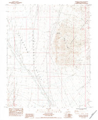
1984 Map of Keyhole Canyon
USGS Topo · Published 1984About this map
Eldorado Mountains and the broad Eldorado Valley define this landscape in Southern Nevada during the early 1980s. The map highlights a significant cultural intersection at the Keyhole Canyon Archeological Site, situated where the rugged slopes meet the alluvial floor. This desert environment is marked by human utility and ancient presence, showing a long-established Pipeline and a Fence line cutting across the valley floor. Water, though scarce, is represented by the central Keyhole Canyon and the Desert Queen Well, which speak to the historic efforts to sustain life and livestock in this arid basin. Industrial activity is indicated by several Borrow Pits and a power transmission line, while the natural drainage of Sand Wash carves through the eastern terrain.
Find a feature on this map
12 named features on this map. Tap any name to fly to it.
Don’t see what you’re looking for? This feature index may not catch every label — zoom into the map to look around manually.
Map Details
Editions of this 1984 Keyhole Canyon Map
This is the sole edition of this map. No revisions or reprints were ever made.
Other maps of this area

1886 · Camp Mohave
USGS Topo · 1:250,000

1892 · Camp Mohave
USGS Topo · 1:250,000

1910 · Ivanpah
USGS Topo · 1:250,000

1912 · Ivanpah
USGS Topo · 1:250,000

1926 · Nelson
USGS Topo · 1:96,000

1942 · Camp Mohave
USGS Topo · 1:250,000

1942 · Ivanpah
USGS Topo · 1:250,000

1947 · Kingman
USGS Topo · 1:250,000

1948 · Kingman
USGS Topo · 1:250,000

1954 · Kingman
USGS Topo · 1:250,000