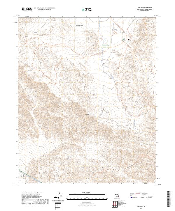
2023 Map of Keys View
USGS Topo · Published 2023About this map
Lost Horse Mine and the Ryan Ranch Cem anchor the northern landscape of this High Desert terrain within Joshua Tree National Park. The land is defined by a network of trails, including the California Riding And Hiking Trl and the Old Lost Horse Road Trl, which trace the routes used by early miners and ranchers through Lost Horse Valley. This survey captures the topographical transition from the higher elevations of Ryan Mtn and Lost Horse Mtn down through the Little San Bernardino Mountains to the lower desert floor.
Find a feature on this map
27 named features on this map. Tap any name to fly to it.
Don’t see what you’re looking for? This feature index may not catch every label — zoom into the map to look around manually.
Map Details
Editions of this 2023 Keys View Map
This is the sole edition of this map. No revisions or reprints were ever made.
Other maps of this area

1941 · Edom
USGS Topo · 1:62,500

1944 · Edom
USGS Topo · 1:62,500

1944 · Pinyon Well
USGS Topo · 1:62,500

1947 · Santa Ana
USGS Topo · 1:250,000

1949 · Santa Ana
USGS Topo · 1:250,000

1953 · San Bernardino
USGS Topo · 1:250,000

1955 · Twentynine Palms
USGS Topo · 1:62,500

1955 · Joshua Tree
USGS Topo · 1:62,500

1956 · San Bernardino
USGS Topo · 1:250,000

1956 · Santa Ana
USGS Topo · 1:250,000