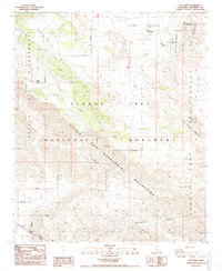
1988 Map of Keys View
USGS Topo · Published 1988About this map
Lost Horse Mine and the Hidden Gold Mine anchor this study of the high desert landscape during the late 1980s. The map illustrates a transitional era for the region, where mining history and early recreation began to overlap within the Joshua Tree National Monument. Evidence of earlier desert life is scattered across the terrain, from ruins and a Lost Horse Well to a lone grave and a small cemetery near the Ryan Campground.
Find a feature on this map
24 named features on this map. Tap any name to fly to it.
Don’t see what you’re looking for? This feature index may not catch every label — zoom into the map to look around manually.
Map Details
Editions of this 1988 Keys View Map
This is the sole edition of this map. No revisions or reprints were ever made.
Other maps of this area

1941 · Edom
USGS Topo · 1:62,500

1944 · Edom
USGS Topo · 1:62,500

1944 · Pinyon Well
USGS Topo · 1:62,500

1947 · Santa Ana
USGS Topo · 1:250,000

1949 · Santa Ana
USGS Topo · 1:250,000

1953 · San Bernardino
USGS Topo · 1:250,000

1955 · Twentynine Palms
USGS Topo · 1:62,500

1955 · Joshua Tree
USGS Topo · 1:62,500

1956 · San Bernardino
USGS Topo · 1:250,000

1956 · Santa Ana
USGS Topo · 1:250,000