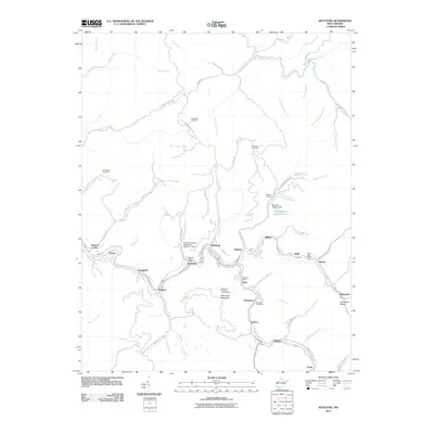
2011 Map of Keystone
USGS Topo · Published 2011About this map
Elkhorn Creek serves as the central artery for a dense network of coal-country settlements, including Northfork, Keystone, and Elkhorn. The 2011 landscape is defined by its industrial heritage, clearly visible through features such as the Keystone Refuse Dump Mine Number 1 Dam and the Algoma Coal Impoundment. These structures, along with several local post offices like the Kyle Post Office and Powhatan Post Office, reflect the social and economic infrastructure built around the region's extraction history. Residential life clings to the steep topography, evidenced by the Thompson Addition and various family-named burial grounds including Mitchem Cemetery and Rotenberry Cemetery. High points such as Shawnee Mountain and its lookout tower provide a vantage over the narrow valleys where roads like E McDowell St and the Elkhorn Station Rd connect these tight-knit communities.
Find a feature on this map
74 named features on this map. Tap any name to fly to it.
Don’t see what you’re looking for? This feature index may not catch every label — zoom into the map to look around manually.
Map Details
Editions of this 2011 Keystone Map
This is the sole edition of this map. No revisions or reprints were ever made.
Other maps of this area

1887 · Pocahontas
USGS Topo · 1:125,000

1891 · Tazewell
USGS Topo · 1:125,000

1891 · Pocahontas
USGS Topo · 1:125,000

1891 · Oceana
USGS Topo · 1:125,000

1891 · Raleigh
USGS Topo · 1:125,000

1893 · Oceana
USGS Topo · 1:125,000

1894 · Pocahontas
USGS Topo · 1:125,000

1895 · Tazewell
USGS Topo · 1:125,000

1895 · Pocahontas
USGS Topo · 1:125,000

1897 · Tazewell
USGS Topo · 1:125,000