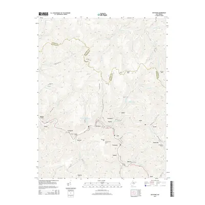
2014 Map of Keystone
USGS Topo · Published 2014About this map
The Elkhorn Creek corridor forms the industrial and residential heart of this region, where the town of Keystone and neighboring Northfork sit tightly within the valley. The landscape is defined by the legacy of coal and infrastructure, evidenced by the Algoma Coal Impoundment and the Keystone Refuse Impoundment perched on the hillsides. These settlements, including Algoma, Eckman, and Landgraff, follow the winding path of Us-52 and the rail line, with the Eckman Overhead Bridge serving as a notable point of transit.
Find a feature on this map
94 named features on this map. Tap any name to fly to it.
Don’t see what you’re looking for? This feature index may not catch every label — zoom into the map to look around manually.
Map Details
Editions of this 2014 Keystone Map
This is the sole edition of this map. No revisions or reprints were ever made.
Other maps of this area

1887 · Pocahontas
USGS Topo · 1:125,000

1891 · Tazewell
USGS Topo · 1:125,000

1891 · Pocahontas
USGS Topo · 1:125,000

1891 · Oceana
USGS Topo · 1:125,000

1891 · Raleigh
USGS Topo · 1:125,000

1893 · Oceana
USGS Topo · 1:125,000

1894 · Pocahontas
USGS Topo · 1:125,000

1895 · Tazewell
USGS Topo · 1:125,000

1895 · Pocahontas
USGS Topo · 1:125,000

1897 · Tazewell
USGS Topo · 1:125,000