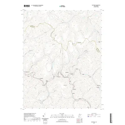
2019 Map of Keystone
USGS Topo · Published 2019About this map
Keystone and Northfork anchor a dense corridor of coal-country settlements along the winding path of Elkhorn Cr. This 2019 survey illustrates the concentrated residential and industrial patterns of McDowell County, where communities like Landgraff, Eckman, and Algoma are linked by a complex network of valley roads and the Eckman Overhead Bridge. The terrain is characterized by steep ridges and deep hollows, such as Greenbrier Hollow and Eureka Holler, which have historically dictated the placement of rail lines and housing.
Find a feature on this map
89 named features on this map. Tap any name to fly to it.
Don’t see what you’re looking for? This feature index may not catch every label — zoom into the map to look around manually.
Map Details
Editions of this 2019 Keystone Map
This is the sole edition of this map. No revisions or reprints were ever made.
Other maps of this area

1887 · Pocahontas
USGS Topo · 1:125,000

1891 · Tazewell
USGS Topo · 1:125,000

1891 · Pocahontas
USGS Topo · 1:125,000

1891 · Oceana
USGS Topo · 1:125,000

1891 · Raleigh
USGS Topo · 1:125,000

1893 · Oceana
USGS Topo · 1:125,000

1894 · Pocahontas
USGS Topo · 1:125,000

1895 · Tazewell
USGS Topo · 1:125,000

1895 · Pocahontas
USGS Topo · 1:125,000

1897 · Tazewell
USGS Topo · 1:125,000